Data
On the Point Data tab, define a customised SQL query to retrieve the collar coordinates of the drillholes that you wish to display.
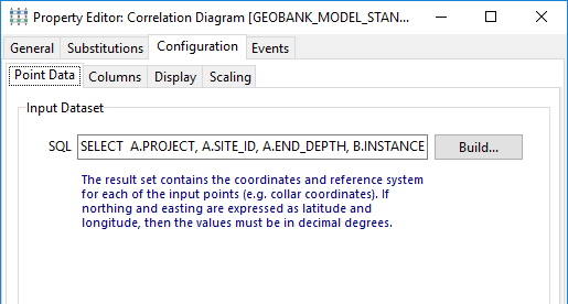
When a new correlation diagram is created, Geobank will provide an example query based on the standard Geobank database model. The Customised Query dialog displays the SQL as well as a list of standard column names required by this process.
The exact syntax of this query will depend on your database structure and the selection criteria needed to return the correct input dataset. If the corresponding column names in your database happen to be different, you can use aliases in the SQL statement to ensure that all the columns are named correctly.
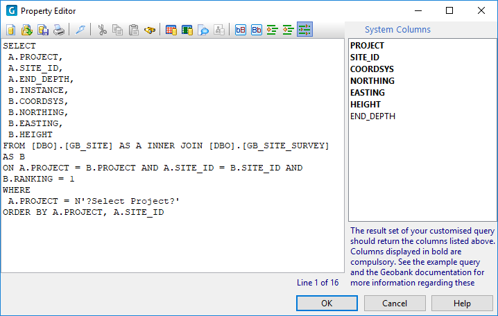
When the correlation diagram is displayed from within the plan view, Geobank will replace this customised query with SQL based on the GB_VIEW_SITE_COORDS view.
Update
The correlation diagram can optionally be used to make changes to the downhole data. The SQL needed to perform these changes is defined in the Editing tab.
Obviously, the update query you define is critical to the success of the database update process; therefore the SQL syntax should be carefully tested to ensure that it delivers the desired result.