Image Registration
Image Georeference
A new Georeferencing Framework now supports picking the coordinates of a georeference control point in a Vizex pane which is docked on the right-hand side of the Georeference Image window.
- A Geolink button can be used to synchronise panning and zooming in the Image pane and the Vizex pane
- An Align button can be used to align the vizex view with the current georeference
- A Lock Plane tool is useful when you want to lock the elevation while making 3D picks to georeference a 2D image
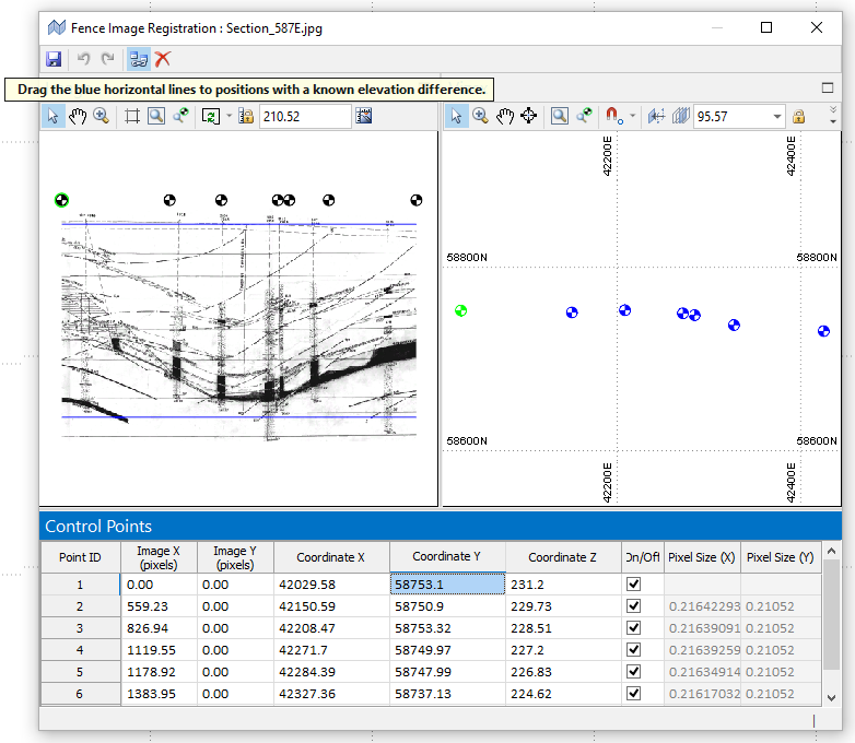
Fence Image Registration
A new Fence Image Registration framework is also supported and opens in a dual-view window which is similar to the Image Georeference window.
Micromine has the ability to georeference (or register) images in 3D, including scans of paper plans or maps. However, this assumes the image represents a single plane, which is frequently not the case.
Fence Image Registration allows a single image to be draped onto multiple, adjacent vertical planes, rather than onto a single vertical plane.
Examples of a fence image are a "section" that bends at every (vertical) drillhole, or a seismic line (or string) that bends because of surface obstructions. In both cases, a single image needs to be draped onto multiple, adjacent vertical planes, rather than onto a single vertical plane.
Fence Image from Drillholes
Select File | Image | Fence Image from Drillholes to select the holes in a drillhole database and then open an image in the Fence Image Registration window with a series of control points based on the holes you have selected.
Fence Image from String
Select File | Image | Fence Image from String to define an input string and then open an image in the Fence Image Registration window with a series of control points defined by the vertices of the string(s) you have selected.