Points Format
Use the Points Format tab of the Generic Output form to generate points from an input implicit model file.
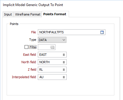
Input
File
Double click (or click on the Select icon) to select an Input file. Typically, the Type of the Input file will be a DAT file containing Lidar point data.
East, North and Z fields
Specify the names of the fields in which Easting, Northing, and (optionally) Z coordinates are stored in the Input file. These coordinates will be used to determine the extents of the generated grid.
Interpolated field
Specify the name of the field to which the results of the interpolation will be written.