GPS
Select File | Export | GPS Formats to export data to various GPS formats.
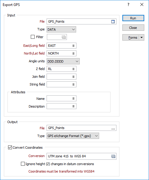
Input
File
Select a (DATA, SURVEY, STRING, PIT DESIGN) file type and then enter (or double-click to select) the name of the file containing the data to be exported. If required, define a filter to selectively control which records will be included in the export process.
When Micromine exports to Google Earth KML format, Point, Polygon or Path (Polyline) placemarks are written to the output file. String and/or Join values in the input file determine the type of placemarks that are written to the output file. If no String or Join values exist, point data is assumed.
East/Long and North/Lat fields
Double-click to select the fields that contain either Eastings and Northings or WGS 84 Longitudes and Latitudes.
The output coordinate system must be WGS 84 Geographic (Latitude/Longitude). If the input data is on a different coordinate system, use the Convert Coordinates option on this form (see below) to convert the data to WGS 84 geographic during the export process
Angle Units
Select the Angle units in which the latitudinal and longitudinal values are (or will be) expressed.
- DDD.DDDD is degrees and decimals of a degree. This is the recommended format. A longitude value of 123° 7' 54.648'' is written as 123.1318467.
- DDDMM.MMM is degrees, minutes and decimals of a minute. Many GPS receivers output data in this format. A longitude value of 123° 7' 54.648'' is written as 12317.9108.
- DDD.MMSS is degrees minutes and seconds. This format is favoured by surveyors and mapmakers, but because it is almost indistinguishable from decimal degrees it is not recommended for locational data. A longitude value of 123° 7' 54.648'' is written as 123.0754648.
Z field
Double-click to select the name of the field that contains Z coordinates.
Join field
In forms that require polylines as an input, the values in this field define whether the data points in the input file should be joined by a line. If successive records have the same value in this field, a line will join the points. If two-factor topology is required, the values in a String field may also be used to segment the lines.
String field
In most forms, the String field is an optional generic attribute used to store a secondary input such as a code. Traditionally, this field has also been used with the Join field to define whether data points should be joined by a line, or strung, hence the name.
Attributes
You can write attributes to the output GPX or GTM output file by mapping the Name and Description attributes of the KML output file to fields in the input file.

Output
File
Enter (or double click to select) the name of the file the data will be written to. Two output file types are supported:
- GTM GPS TrackMaker is a communication program to connect GPS to PC. The GPS TrackMaker (GTM) binary format is an input/output format for waypoints, tracks and routes.
- GPX GPX, or GPS eXchange Format is an XML schema designed as a common GPS data format for software applications. It can be used to describe waypoints, tracks, and routes.
Convert Coordinates
Select the Convert Coordinates check box to convert local or projected coordinates prior to export.
Conversion
Select, or create a new, coordinate conversion form set. See: Setup
Ignore height (Z) changes in datum conversions
Height (Z) coordinates are optional inputs to the process. Select this option to limit the transformation process to the X and Y coordinate fields.
Coordinates must be transformed into WGS 84 geographic (latitudes and longitudes).