Export to IREDES
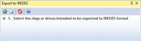
Select Mining | Ring Design | Export to IREDES, or click the Export button on the Ring Design Toolbar to export a Ring Design Database to IREDES file format.
When exporting to an Epiroc formatted IREDES file, you can select an option to write navigation holes to the output XML file. Navigation holes are used for the positioning of the drill rig and for the conversion of the coordinates to those of the Rig Control System.
International Rock Excavation Data Exchange Standard (IREDES) is an industry standard to unify routines for the data exchange between mining equipment and office computer systems. The input/output file type is XML.
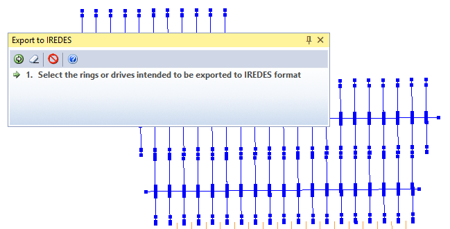
A Ring Design layer must be open in Vizex and be the active layer. You will be prompted to select the drives and rings you want to export:
If you select a drive, all the rings on that drive will be included in the export. You can also use the mouse to select multiple drives and rings. To exclude or add individual rings, use the mouse with the CTRL key to refine your selection.
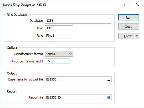
Ring Database
When you have selected a drive and the rings to export, the Export Ring Design form is displayed.
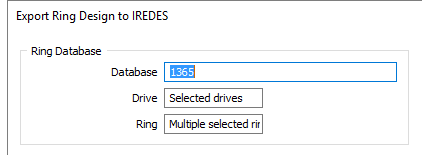
The Ring database and the drives and rings you have selected in the display are shown in the Ring Database group and are display only. You cannot change the selection unless you close the form and reselect them interactively.
If you have selected multiple drives and rings, this is reflected in the Drive and Ring prompts:
Options
Manufacturer format
The Export format differs based on manufacturer. The following format is currently supported:
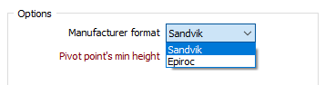
Options: Sandvik
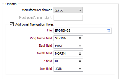
When Sandvik is chosen as the manufacturer format, the Lowest Pivot Point is used as the origin to transform the design coordinates to rig drill plan coordinates. This point then becomes point 0,0,0 on the rig. Holes are exported in transformed coordinates such that the Pivot point for the hole is the start of the hole and the Toe point is the end of the hole.
You must specify the minimum height of the pivot point (of the rig’s boom) from the floor of the drive, and specify the name and the fields of an output String file.
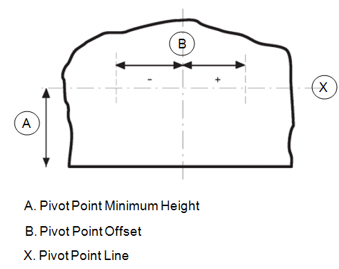
Pivot point’s minimum height
The pivot point is an agreed, real position in the tunnel and must be known before designing a drillhole fan. The X-axis is also called the pivot point line. The minimum height of the pivot point line must be determined and is limited by the physical dimensions of the drill rig. All of the holes on a ring must start from the pivot point line, either from a single point on the line in the case of a fan, or with each hole having its own starting point.
When Sandvik is chosen as the manufacturer format, navigation hole information ??? must be written to an Output file. You can also specify (Site, Area, Level, Stope, and Drift) Location Attributes.
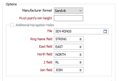
Options: Epiroc
When Epiroc is chosen as the manufacturer format, the Reference Point is used as the origin to transform the design coordinates to rig drill plan coordinates. This point then becomes point 0,0,0 on the rig. Holes are exported in transformed coordinates such that the Collar point is the start of the hole and the Toe point is the end of the hole.
The option to write additional Navigation holes to an Output file is provided. You can also specify (Site, Area, Level, Stope, and Drift) Location Attributes.
Output
Base name for the output file
A separate output file will be generated for each ring on each drive. A suffix is added to the base name to make each name unique.
Report
Report file
Enter or double-click to select) the name of a Report file.